-
A Grave Responsibility to Honour Our Ancestors

Under the Aboriginal Land Rights Act, we have responsibilities and a statutory role to: (a) Take action to protect the culture and heritage of Aboriginal persons in the council’s area, subject to any other law; and (b) Promote awareness in the community of the culture and heritage of Aboriginal persons in the council’s area. This documents our way of proceeding.
-
Mapping the Graves of the Mapoon Mission Cemetery, Queensland, Australia
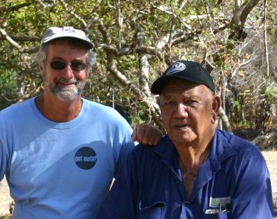
Aboriginal people in Cape York Peninsula area of Australia have strong emotional attachment to cemeteries and the burial places of their ancestors. Often, as at Mapoon, in northern Queensland, many such places are unmarked and neglected. The graves can be difficult to identify on the ground surface, either because they were never marked, or because the grave markers have subsequently decayed, been removed or destroyed. They were discovered and mapped with GPR
-
Geophysical investigations were conducted at the La Purisima Mission State Historic Park to understand potential impacts due to the proposed development of a new visitor’s center.
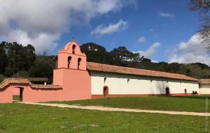
Geophysical investigations were conducted at the La Purisima Mission State Historic Park to understand potential impacts due to the proposed development of a new visitor’s center. The portion of La Purisima State Park studied is located near the park entrance, just north of the intersection of Purisima Road and Mission Gate Road, in Lompoc, California. Field surveys using four geophysical techniques were conducted on September 23-25, 1999 and October 27-29, 2000 to search for buried objects and structures associated with historic occupation of the site. Four geophysical techniques were employed at La Purisima: ground penetrating radar (GPR), electromagnetic conductivity (EM),…
